Tuesday 20 August 2013

Unexpected news changes my plans

I concluded my last post having arrived at my B&B  'Sea Kindly' near Egerton, Nova Scotia, after a long day travelling the length of Cape Breton Island then back onto the mainland.  

Checking messages whilst I sat in the lounge drinking tea I spotted a message that's a great shock.  It was to change the end of my road trip.

In my journey so far I have mentioned about Assynt, where Rev Norman MacLeod and his followers left there and settled in Canada in the 1800's.  I had visited his memorial at the Gaelic College at St. Ann's Bay, so often Assynt had come up in conversations in that last week.  

It was often in these discussions about the settlers in Nova Scotia, that I had related my connections with Assynt in relation to the first ever buyout of an estate by the Assynt Crofters.  I had covered it for TV news for more than a year, then when they got the land filmed a documentary of their first year.  Little did I realise back home on this very day those pictures were again making the news.

Allan MacRae, leader of the Assynt Crofters Trust had been found dead on his croft.  This picture is a frame from my film of the moment he announced their success in the purchase of their land.


"Well ladies & gentlemen it seems we have won the land … it's certainly a moment to savour, no doubt about that. Certainly my immediate thoughts are to wish that some of our forebears could be here to share this moment with us".

Whilst I have a copy of the documentary, I'm only able to share with you this clip of that moment...


"...wish that some of our forebears could be here to share this moment with us".

That phrase had already been in my mind during this trip when Assynt had been discussed.  Perhaps had land ownership been different not so many people would have left Scotland? It could be that people I had spoken too in my travels especially in the last few days were related to some that had left Assynt?

Gaining possession of the land in Assynt was the first ever community in Scotland. For me it was the first documentary I had done all the filming and sound on location, nobody else was involved.  It was only the producer, editor and commentary that was completed by others back at the studio, every single bit of footage was mine.

The Head of News & Current Affairs at Grampian TV sent me a broadcast quality BetaSP tape of the programme, it was a North Tonight Special 'Great Day at Split Rock', I still have it twenty years on ...


Split Rock is a well know feature of Assynt where it is pounded by the sea, the title used that as its background

With the time I spent covering it for Grampian TV news before the decision, then the year long documentary afterwards, it meant it was by far the longest period I had spent covering one remote community.

It was at that point I decided I should consider changing the end of my road trip and try to arrange to return to the Gaelic College at St. Ann's, Cape Breton, to see the premiere of the play 'Out of Black Cove'.  I had been told by Ian Green at Colourtura Art Gallery about the play, and that it related to the folks who left Assynt and ended up in Cape Breton.
That's on my post 'Heading North'  for the more information (click on link)

After thinking about it overnight I thought making the trek back to see the play was the right thing to do if I could make it happen. It so happened that I had only booked ahead accommodation for the next two nights, both at the same motel. All my accommodation to date had been booked from home in advance, upon reflection I would have been better not doing one night stops for a full week at a stretch.  When I got to the motel I would work out the rest of my road trip, as the rest of the trip hadn't been booked.

After a wonderful overnight stay at  'Sea Kindly' , they were superb hosts, it's time to leave ...


Just as well the house is on top of a hill because next stop is where they have the highest tides in the world !   More on those next post … 


Saturday 10 August 2013

Fog, fire, fiddles and a phonograph

It's still Wednesday, 26th June 2013, so far today I left the B&B at Cape North, drove a couple of miles to Dingwall, returned the same way as far as the North Highland Community Museum , just half a mile from the B&B.  All about that initial part of the trip was in the last post.

Now I head south on the Cabot Trial for Inverness, via Dunvegan, but my destination tonight is still over 200 miles away.  There's a problem, I haven't gone far on this remote Highland road before I'm in fog, thick fog, and can only just see the sides of the road !  Sometimes there's forest to the side other times I can't see anything beyond the road side.  I'm crawling along until I come up behind another vehicle which is going even slower, after a while I decided to pull off onto a 'look off' point, except over the walled edge I could only see fog !

I headed off again on this high level road and it wasn't until I reached the downhill stretch towards the sea that I came out of the fog / cloud, it had been over 30 miles of fog.

If you go to this link on Google maps street view  you can see the same view but also move the camera view around and look up and down the road too


Looking back up the hill, you can make out the line of the road cut in the hillside the I have just come down

A short distance further on at the next 'look off' point, in the misty distance I can see the road over which I will be driving.


Again if you go to Google maps street view you can see the same scene including the road


Just by where I took that picture is this memorial, there's a close up of the text below


There are scattered settlements which I would have liked see, but I had long way to go today. 
I drove on through Dunvegan and Cheticamp, until I eventually reached Inverness, but as you may spot, the Gaelic version does not match the one for Inverness in Scotland !


( click on small pictures to enlarge)


All these pictures were taken within a few hundred yards along the main street, not sure if the Inverness Volunteer Fire Department has more vehicles behind the closed doors, but they do seem a little limited for parking space!


This was a mining area and has several museums, but sadly I really didn't have time to stop any longer, by now I had realised over recent days there's far more to see than anticipated ! However, Inverness is a county as well as a town, this link is to the history of the town  but there's also a lot of information about the area too.


Maybe ten minutes drive out of town where the road goes inland for some miles is the Glenora Distillery which has an impressive entrance off the main road, then down a treelined driveway to the beautifully located property


I went through the door into the reception area and gift shop to the left,  I waited a while, tried to attract someones attention in what seemed an unattended building, but I failed.  I went through to the other side of that double doorway, below is the view.  
Considering they have a gift shop / reception, restaurant & accommodation, there were no further signs that I could find as to where to go !  It may have an impressive entrance from the road, wonderful grounds and beautifully kept, but staff too may help?    Obviously I wasn't going to get a meal there, so it was back on the road for me !

Fortunately only another ten minutes drive away in Mabou I spotted The Mull Cafe & Deli, a great and friendly place where I got chowder soup and a roll, as well as tea.


Another half hour drive and I spotted the Celtic Music Interpretive Centre, at Judique  A very welcoming place that at lunchtime and evenings has a restaurant and live music.  However that's just a tiny fraction of what they do as you will see on their website

Whilst around the north of Cape Breton the main road is the 'Cabot Trail' , I left that part way down the west coast as that goes inland and back towards St. Ann's to complete the circle. On the stretch of coast I'm now on it's the 'Ceilidh Trail'    (See maps on the links)   Throughout this trail you are likely to find live music and ceilidhs in many establishments, although it wasn't something I was seeking out but came across in my brief drive through.

At the Celtic Music Interpretive Centre I was invited by the CEO to look around their collection and take some pictures.  As you will see it's not just musical instruments but radio, record players and a phonograph too.

(Click on small pictures to enlarge)


There's still 80 miles to go to my B&B, the first 20 miles is to the Canso Causeway where I leave the wonderful Cape Breton Island.  From that point onwards all but the last few miles is on the Trans Canada Highway, so I'm heading for Vancouver !

I regret not having time to stop by Antigonish which is home of the first ever Highland Games in Canada held in 1861 and continues annually to this day.  The link will tell you its history from over 2500 ago.  As the town website explains:

Antigonish is a Mi'kmaq name and, depending upon whom you ask, has two quite distinct meanings: 
1. The place where the branches are torn off by bears gathering beechnuts. 
2. Meeting place of five forked rivers.
(West River, South River, Brierly Brook, Wright's River, and east Wright's River)

Tonight I'll be staying at Egerton, which is not far away from where the Rev Norman MacLeod and his followers landed at Pictou after sailing from Assynt in the NW Highlands of Scotland. That was way back in 1817, before they moved on to St Ann's on Cape Breton Island that I visited earlier (reported here)

My B&B emailed driving instructions for the last leg to advise me not to follow either a map or satnav because junction 27 on the Trans Canada Highway had been moved !  It's now a mile away from where it used to be, which is not a problem obviously, it's just all the roads from that junction have changed.  

Well it wasn't as easy as anticipated, finding junction 27 is no problem, it's just that once you go of the slip road it's into a double roundabout.  For the likes of me driving on the 'wrong' side of the road it's the first roundabout I have encountered, and it's got to be a double one ! There's something unnatural driving around anticlockwise, and when there's a double one that makes it even worse.  Trying to check sign posts, places and road numbers was a bit beyond me, going anticlockwise was as much as my brain could cope with at the moment. I made two complete circuits of the entire system before I aimed off in the right direction.

My B&B 'Sea Kindly' was maybe a mile along an unpaved road, on a slight hill by the sea.  My host appeared to greet me, carried my case in, it proved to be a splendid and very homely place.


The total route for 26th June 2013 on Google maps

I was offered a tea in the lounge, I sat there checking messages.  One was a shock, it was to change the final part of my road trip, but that will have to wait until the next post  ....


Thursday 8 August 2013

Dingwall to Inverness ?

Yesterday was a long day, can't believe all the things I saw from leaving the motel at St. Ann's and arriving at Cape North (route on Google maps), yet it was only about 75 miles of driving !

Leaving the B&B on Wednesday 26th June 2013, I have to back track just a short distance, passing Tartan & Treasures again to head a bit further north off the main road.  That's because I wanted to visit Dingwall, with it being my nearest town at 50 miles away back home in Scotland.   There's certainly no similarity !
This sign is just after turning off the main road, but the settlement is a bit further.
(Click on small pictures to enlarge)

Which maybe why there's another sign a mile or so further on?

I did pass a cluster of houses before the road came alongside this inlet, this is actually looking out to sea.
It's more obvious a bit further on, the inlet is around that promontory to the left, whilst not far away it seems such a different landscape in just a short distance.

Now I have gone around to the other side of the inlet of Dingwall Harbour. so the road I was on is behind those properties and the sea view off the the left.


This highlights one of the differences between small harbours in the Highlands of Scotland and in Nova Scotia. The harbours in NS can often be a collection of individual jetties and mooring scattered throughout an area in a bay, rather than one central point and is usually the case in Scotland?

It is a very scattered community, but returning to near where I saw the 'Peaceful Fishing Village' sign this is one of the houses.

Across the road the rather forlorn looking Stardome Hall which has seen better days.


Time now to back track again and return to the main road, because beyond Dingwall there's no exit, it's remote roads to isolated settlements on the coast.

Back the short drive to the main road, I once again drive past Tartan & Treasures, also the track to my last B&B, less than half a mile beyond the main 'Cabot Trail' does a sharp left turn at its most northerly point.  Unfortunately my satnav had other ideas never uttered a word and I went straight on along the Gulf of St. Lawrence road !  

Fortunately I spotted the problem immediately and pulled across to a parking area to turn around.  It was then that I spotted I was outside the 
North Highlands Community Museum & Culture Centre.


What an amazing place this turned out to be, especially for a very small and scattered community, it really would have done any town proud, let alone this small remote population.  I was parked outside the 'Settlers Garden' so what better place to start?


Hay Barrack


Quoted from the Museum website:

The Settlers Garden is the product of a years intensive effort in design, construction and planting, culminating in the Grand Opening on August 3, 2008. 

The garden represents, in miniature, the natural and cultivated world of the early European settlers who made their homes in the North Highlands of Cape Breton.
Each of the ten individual gardens is a facet in a gemstone, and each may be seen as a source of food. 

There is nourishment for the body (the Fruit, Vegetable, Grain, and Cooking Herb gardens, as well as fruitful Native shrubs and trees); food for health and the spirit in Medicinal herbs; food for the soul in the old-world Heaths and Heathers; a feast for the eyes and food for nostalgia - in the Cottage Garden.

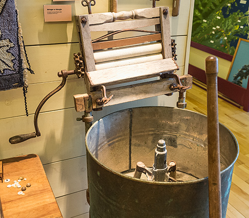
Inside the quality of displays and content of the displays is exceptional for this Community Museum.


 (Click on small pictures to enlarge them)


Being there early in the morning, actually the first person there, some of the activities weren't yet on the go, for example the Blacksmiths Forge, but a lot of other things happen there.  There's also access to the internet, wi-fi, and a Genealogy Centre too.

What struck me was there were three staff, all local teens or maybe early twenties at the most.  They were so enthusiastic, friendly and knowledgeable, with a keen interest in their local area, culture and history.  For a remote Community Museum, with such a splendid collection, they were a credit to their community just as much as the museum itself is a credit to the area.  

It's certainly a must visit location, so if you visit the area don't miss North Highlands Community Museum at Cape North (Google map location)

So far today I had only travelled about 5 miles which included backtracking to get to Dingwall initially (route) yet I've go over 200 miles to get to my B&B tonight.  So I have been to Dingwall, but I have to go to Inverness via Dunvegan, which in Scotland would be a lot further…... so better get on the road again !